Blog
Signs of Climate Change– A Wild Ride of Water Levels
 Recent flooding and elevated water levels in our rivers and Great Lakes have captured the attention of the media and our region as we grapple with the effects. The reason for this roller coaster of water levels is complicated, and related to a global pattern of volatile weather and climate events. Many Climate experts have predicted higher “highs,” and lower “lowers on the Great Lakes in addition to an increase in extreme wet-weather events, punctuated by periods of drought in our region.
In recent years, other unusual weather events have caused panic including a decade of low winter water levels and less ice cover culminating in a record low for Lake Michigan in 2013. Over the long term, many predictions were that warmer temperatures in the Lakes would lead to less ice cover accumulation during winter months, more evaporation, and dropping water levels over time. And indeed, from 2000-2013 or thereabouts, Lake Michigan was well below average water levels. In 2013, Lake Michigan broke a record for the lowest water level ever recorded at 576.02 feet in July, prompting panic and emergency dredging in many areas of WisconsinIn 2014, water levels began to rise due to changing weather patterns, including more extreme weather events, precipitation increases, and several years of good ice cover (remember those polar vortexes?).
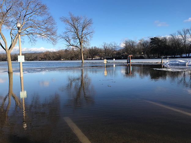
Cue this year. Due to increases in precipitation, Lake Michigan water levels have been at or near record high water levels all year. Lake Michigan is up a staggering 6.2 feet from six years ago, breaking its high-water record of 33 years on July 23rd—at 582.18 feet. While the lakes have always naturally fluctuated, many underestimated the effects of climate-enhanced “swings” in precipitation and evaporation on these huge bodies of water. Lake Michigan water levels have increased about 12 inches per year for the last 6 years, which is unprecedented.
High lake levels have caused some havoc in the Milwaukee area, especially downtown where the three rivers meet in the Milwaukee Estuary. In this area, water levels are heavily influenced by Lake Michigan because the rivers downtown were historically modified and dredged to be a similar water depth as Lake Michigan to facilitate shipping. Upstream, the river flows are more influenced by local rainfall events and conditions—but are also experiencing more variability. Several downtown riverfront businesses had to close due to flooding from high water levels this summer, and others are still pumping water out of foundations on an almost continuous basis.
Similarly, high river levels have forced water into some sewage and stormwater pipes, which must be continually pumped out to protect properties from sewage backups. Other buildings have been unable to install piers, due to their anchoring infrastructure being well underwater, and others have had to build new ramps or structures to allow water users to safely access our rivers and Lake.
In addition, high water levels and lake level surge has caused some navigation issues where break walls, buoys, and other obstructions are under water, posing safety concerns to boaters. Throughout the Great Lakes high waters and wave action means beaches,bluffs, vegetation and built structures are disappearing and being damaged at an alarming rate. Both people and pets have been swept off piers, and many have drown in riptides this year. Experts expect water levels to only minimally decrease in the next few months, meaning we could see storm surges that further threaten our coasts, bluffs, homes, and residents. Many Great Lakes habitat areas have also been damaged by high waters and wave action that have increased erosion and impacted vegetation and built structures.
So what is the new normal? Many experts predict continued variability in lake and tributary river levels, and more surprises to come for our Great Lakes and shore land communities. It is important that we find ways to adapt to this variability that protect our natural resources, our public health, and our quality of life.